- The paper introduces a centralized SLAM system that merges USV and AUV data using indirect loop closures based on common structural observations.
- It leverages LiDAR and sonar modalities, employing novel sonar data compression and robust PCM outlier rejection to enhance mapping accuracy and efficiency.
- Experimental validation in diverse maritime environments shows significant localization error reduction and practical real-time performance.
Centralized Multi-Robot SLAM Across Surface and Underwater Domains
Problem Statement and Motivation
This work introduces a centralized SLAM system designed for heterogeneous robot teams comprising Uncrewed Surface Vessels (USVs) equipped with 3D LiDAR and Autonomous Underwater Vehicles (AUVs) utilizing imaging sonar. The complexity of underwater localization, due to the absence of a global positioning system and degraded perceptual data, motivates integrating robust surface localization (USVs) with underwater mapping capabilities (AUVs). Traditionally, multi-robot SLAM in maritime domains has depended on direct encounters via acoustic ranging, which require physical proximity, unobstructed signal propagation, and often clock synchronization. This research circumvents those constraints by introducing loop closure mechanisms based on common structural observations—structures visible both above and below the waterline—enabling indirect encounters and scalable cooperative perception.
System Architecture and Algorithmic Innovations
The system comprises a USV-centric, centralized SLAM backend integrating state estimates and perceptual data from multiple AUVs. Each robot autonomously computes its local state estimate; AUVs leverage DVL+IMU dead reckoning with pose graphs, while the USV utilizes LiDAR odometry via KISS-ICP. At discrete intervals, AUVs communicate compressed sonar features and pose estimates to the USV, which merges incoming data using inter-robot loop closures.
Loop closure search exploits range-based scene descriptors derived from both 2D sonar contact maps and surface LiDAR scans, mapping common structures for cross-domain alignment. The USV preprocesses 3D LiDAR maps by height cropping and axis reduction to match the 2D sonar domain, facilitating registration via Go-ICP and further refinement with standard ICP. Loop closure candidates are verified with robust outlier rejection using PCM, ensuring geometric consistency.
Notably, the proposed sonar data compression method leverages rectangle grouping of CFAR-selected contacts to minimize communication bandwidth while preserving cell resolution, outperforming grid-based compression strategies such as those in DRACo-SLAM.
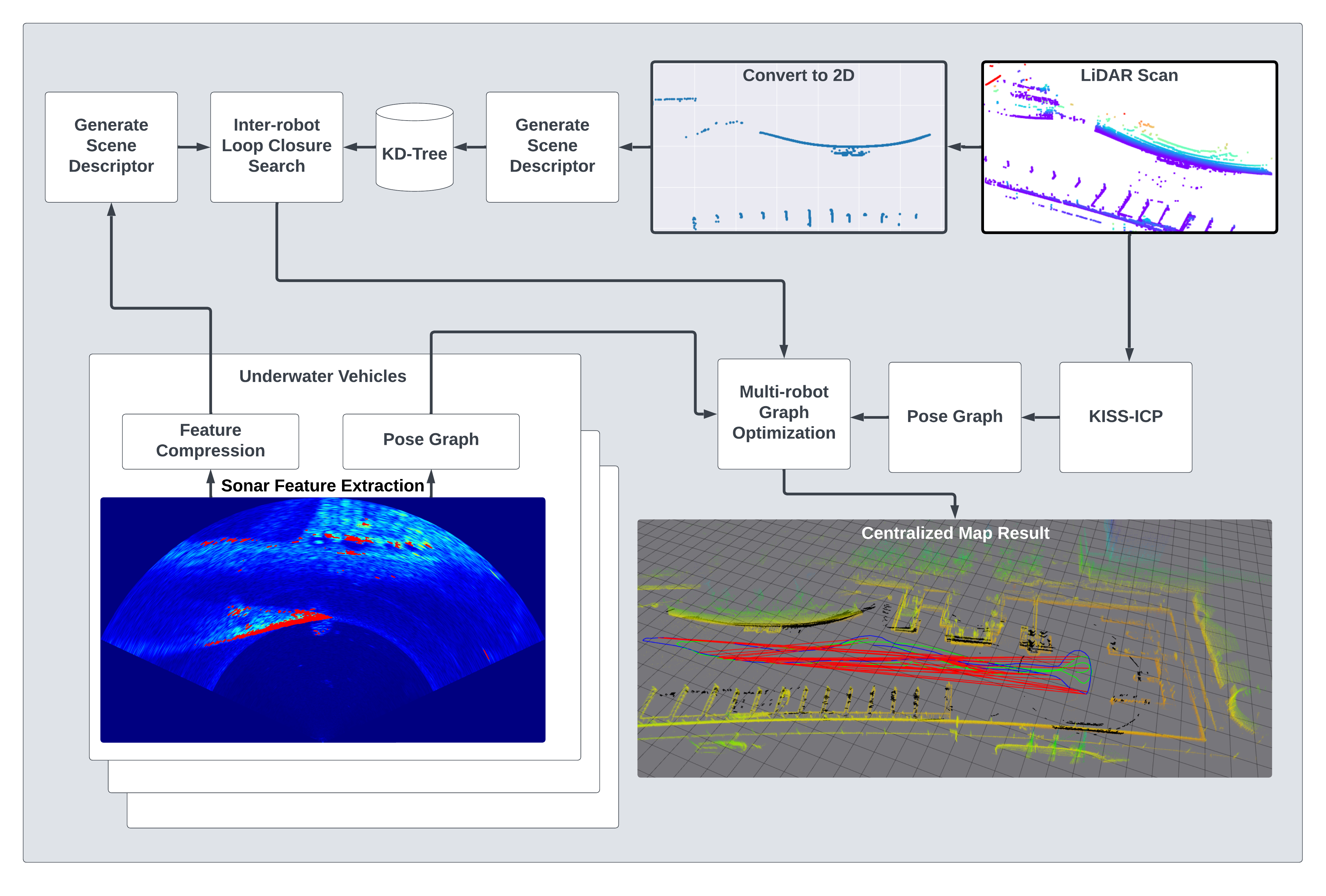
Figure 1: System workflow illustrating distributed data collection, compression, pose graph construction, and centralized loop closure search.
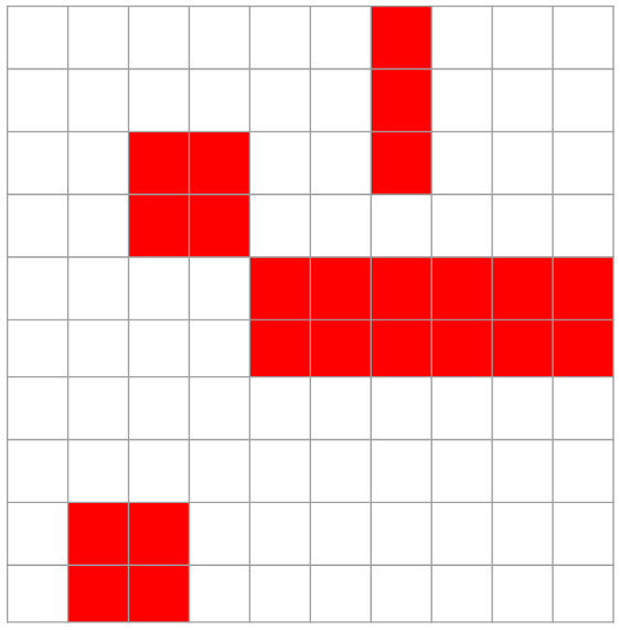
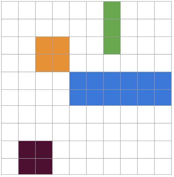
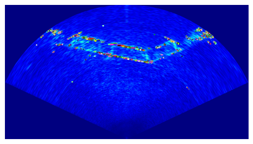
Figure 2: Sonar data compression demonstration, showing reduction from raw contacts to grouped rectangles for efficient transmission.
Experimental Validation
Datasets were gathered with a modified ClearPath Kingfisher platform, equipped to function alternately as USV or AUV, in three real-world maritime environments: bridge, waterfront, and harbor. Each scenario involved simultaneous trajectories from one USV and two AUVs, validated against RTK-GPS ground truth. The environments represented structurally diverse, complex littoral domains with numerous above/below water features.
Ablation studies evaluated the impact of sonar window size and PCM outlier rejection on SLAM performance, demonstrating that larger window sizes consistently reduced error, with PCM enhancing robustness, particularly in structurally repetitive environments characterized by perceptual aliasing. Comparison to single-robot underwater SLAM baselines showed substantial improvements in mean absolute error (MAE) and root mean squared error (RMSE) across all cases with effective loop closure—e.g., in bridge scenarios, centralized SLAM improved MAE to 2.8 m versus 3.35 m for single-robot SLAM.
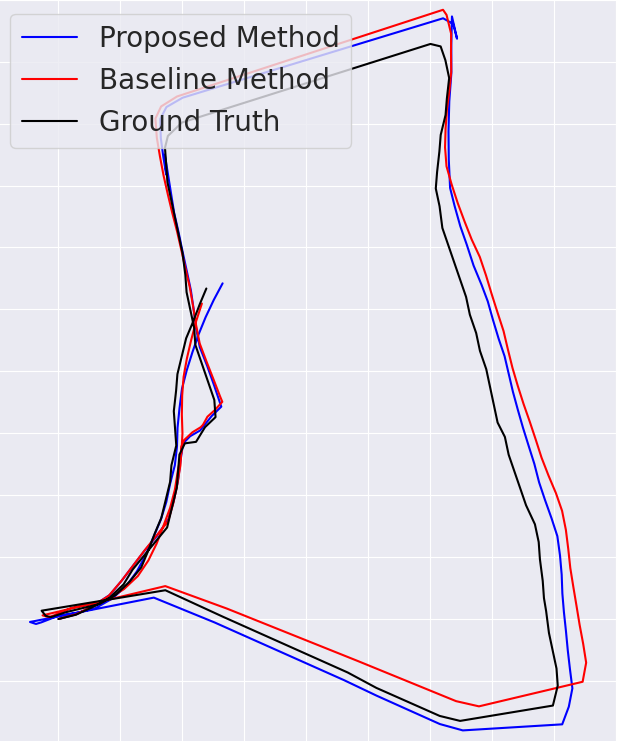
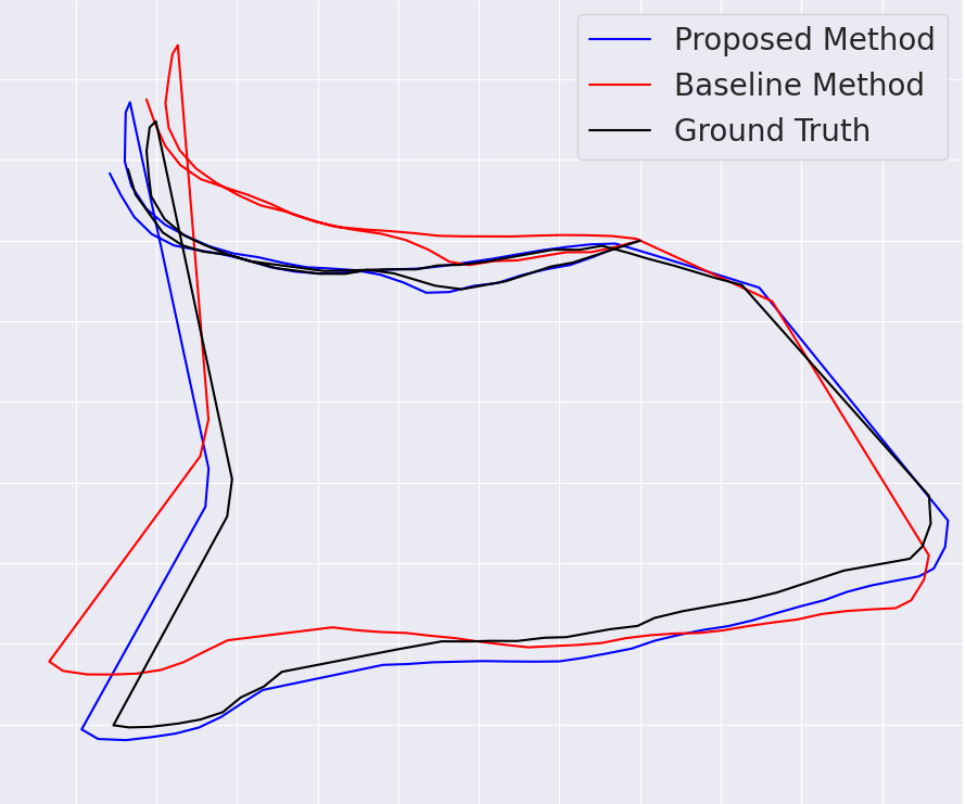
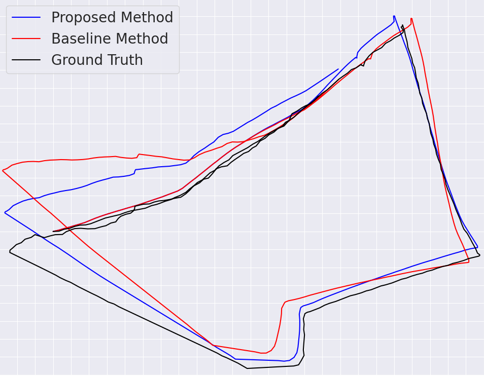
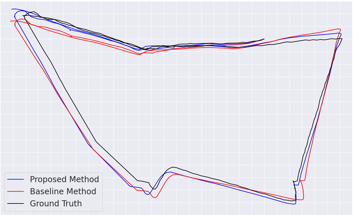
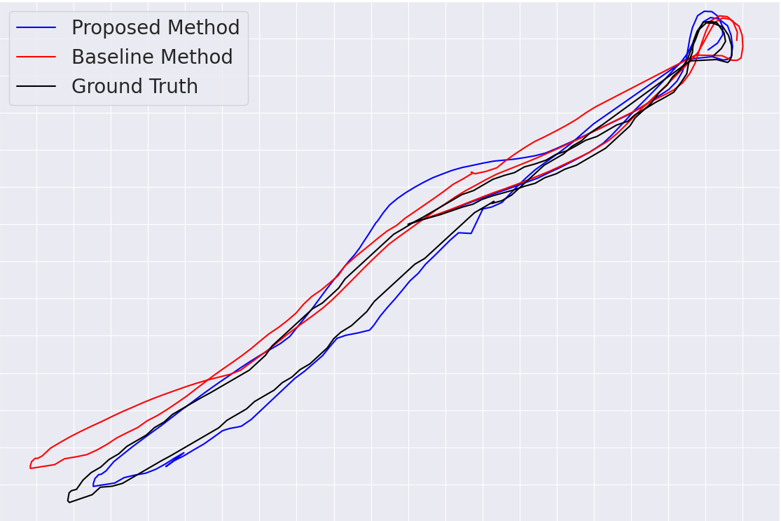
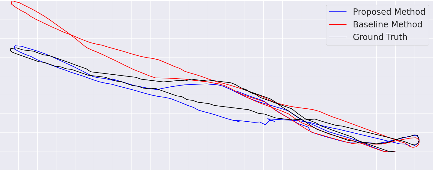
Figure 3: Trajectory overlay plots for three environments, showing RTK-GPS ground truth, baseline single-robot SLAM, and proposed centralized multi-robot SLAM results.
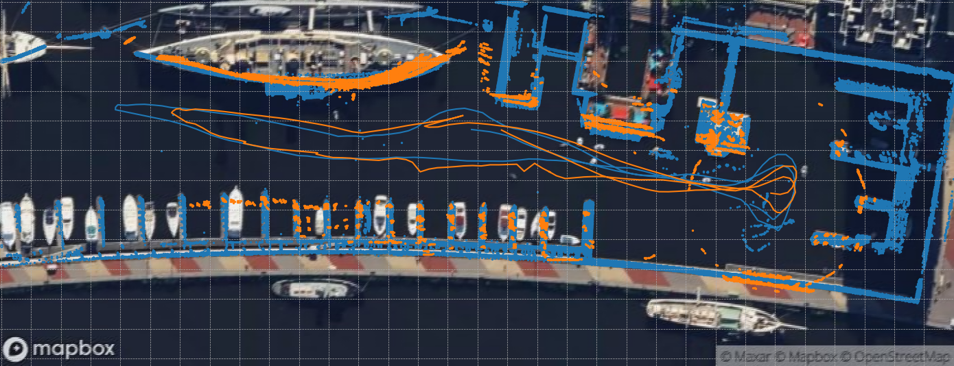
Figure 4: Composite map integrating LiDAR and sonar returns with robot trajectories from a multi-robot mission in the harbor environment.
Perceptual Data and Runtime Analysis
Bandwidth constraints are critical in underwater scenarios. Experimental message sizes demonstrated drastic reduction from raw sonar images (1978.37 k-bits) to CFAR rectangle compression (mean 5.63 k-bits). This efficient compression yields communication rates (0.95–3.38 k-bits/sec) well within the bounds of commercial acoustic modems (≤62.5 k-bits/sec), indicating practical deployability.
Runtime profiling indicated point cloud registration represented the primary computational bottleneck (mean 766 ms), whereas PCM and compression modules executed well below data acquisition rates, supporting real-time operation over discrete keyframes.
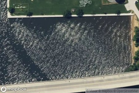
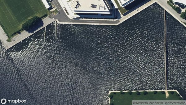


Figure 5: The three test environments and the Kingfisher robot used for data collection.
Implications and Future Directions
This work establishes a paradigm for cross-domain multi-robot SLAM leveraging indirect loop closures via perceptual overlap between above-water and underwater structures. Practically, it enables more robust, distributed mapping and localization in complex, cluttered maritime environments where acoustic ranging is unreliable or infeasible. The compression and communication strategy are directly applicable to resource-limited underwater sensor networks, advancing state-of-the-art in marine robotics.
Theoretically, this approach enables SLAM systems to exploit heterogeneous sensing and structural priors, extending loop closure concepts beyond homogeneous sensor modalities. Strict outlier rejection is necessary due to high perceptual aliasing; however, the potential for missed loop closures suggests a future trade-off between robustness and sensitivity, ripe for further investigation.
Anticipated developments include integration of real-world acoustic communication hardware, field validation under operational constraints, and hybridization with direct encounter range measurements, promising increased accuracy and operational resilience.
Conclusion
This research articulates and validates a novel multi-robot SLAM system uniting USVs and AUVs via perceptual loop closures, eschewing reliance on direct acoustic ranging. The centralized, cross-domain mapping framework demonstrates significant localization error reduction and efficient bandwidth usage, enabling practical multi-robot cooperation in challenging maritime environments. The approach sets the stage for distributed, robust underwater mapping applications and opens new avenues for heterogeneous SLAM methodologies in AI-driven marine systems.