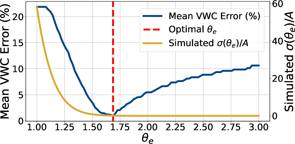
- The paper introduces a novel sensing pipeline that integrates nadir wideband radar with LiDAR to enable accurate through-canopy soil moisture measurement.
- The paper demonstrates precise soil moisture retrieval with a volumetric water content error below 4.5% and maintains altitude-invariant performance.
- The paper validates a physics-based radiative transfer framework that robustly decouples soil and canopy signals across varied canopy densities and field conditions.
Through-Canopy Soil Moisture Sensing with UAV-Mounted Radar: An Expert Synthesis of GreenScatter
Introduction and Problem Context
GreenScatter addresses the persistently hard problem of retrieving soil moisture profiles in agricultural fields during periods of significant canopy coverage, conditions under which established optical and RF remote sensing modalities generally fail to decouple vegetation and soil contributions to the measured signal. The work departs from prior side-looking polarimetric SAR and GPR attempts by fusing nadir-looking wideband radar with LiDAR measurements, and implements a fully physics-based radiative transfer framework to explicitly model the underlying EM interactions. The design delivers high spatiotemporal resolution and practical deployment via UAVs, with consistent field-demonstrated volumetric water content (VWC) retrieval error below 4.5% across a range of canopy densities and types.
Unlike instrumentation-heavy in situ approaches or single-modality remote methods encumbered by platform-dependence, canopy geometry, and limited physical observables, GreenScatter formalizes the sensing and inversion pipeline and renders it field-robust and generalizable.
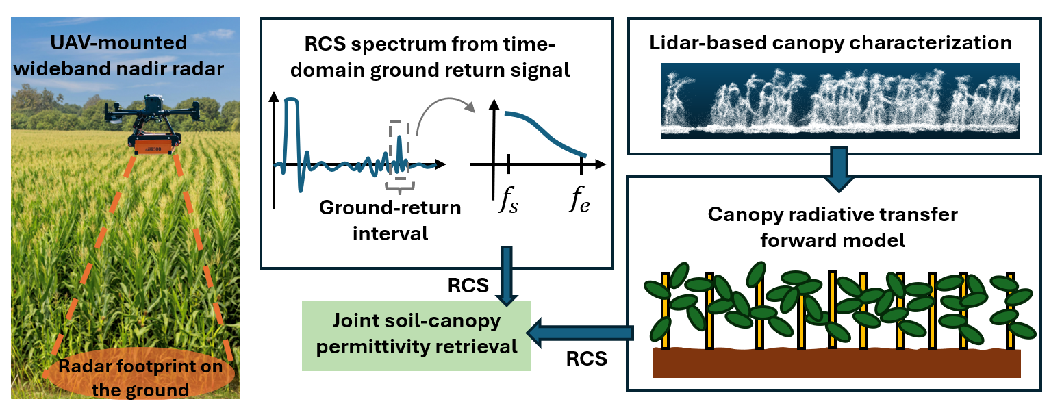
Figure 1: GreenScatter offers robust soil moisture sensing through canopy using UAV-mounted radar.
System Architecture and Physics-Driven Modeling
The central technical advance derives from the use of a nadir wideband radar geometry, which admits a strong, coherent ground reflection even in the presence of full crop canopy, circumventing the persistent coupling of scattering mechanisms seen in side-looking observations. This configuration maximizes the sensitivity to underlying soil properties and simplifies the parameterization of radiative transfer, as only the transmittance/attenuation through the canopy needs to be modeled rather than higher-order multiple scattering or dihedral terms.
Figure 2 summarizes the GreenScatter computational pipeline: time-domain radar returns are range-gated, clutter-suppressed, and spectrally mapped to calibrated ground RCS, fully compensating for hardware and spectral shaping effects via a one-time reference calibration procedure. Parallel LiDAR-derived morphological parameters (height, LAI, density) allow for dynamic parameterization of canopy extinction coefficients in the radiative transfer equations, enabling joint inversion for soil and vegetation dielectric properties.
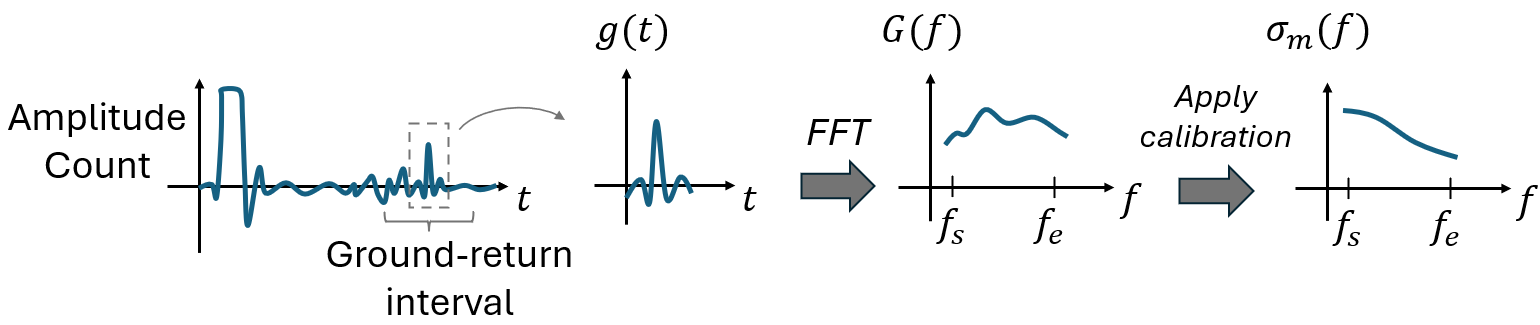
Figure 2: GreenScatter pipeline from raw radar measurement to ground RCS estimation.
The radiative transfer model builds upon [burgin_generalized_2011], utilizing discrete scatterer representations for stalks (modeled as cylinders) and leaves (disks), and computes cumulative two-way attenuation as a function of frequency, canopy structure, and incidence angle. The soil model leverages Kirchhoff solutions for specular coherent backscatter, with roughness effects encapsulated in an exponential decay, and direct parameter linkage to dielectric permittivity reflects true moisture values.
This physics consistency enables robust joint inversion, as demonstrated by stable retrieval performance across the practical field conditions and drone altitudes.
Experimental Design and Field Validation
GreenScatter was deployed extensively across multiple fields (corn, soybean, and bare soil), at various growth stages and after several environmental disturbances, including rainfall events. The platform integrates a commercial GPR (200–900 MHz), GPS/IMU georeferencing, and high-density LiDAR atop a stabilized UAV.
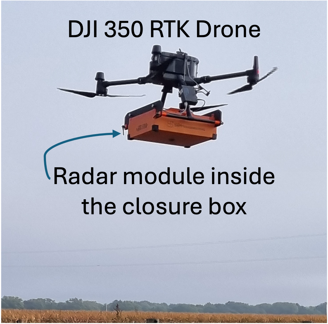
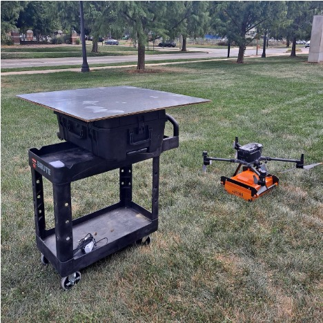
Figure 3: Our UAV prototype.
Experimental ground truth for soil VWC was acquired via standardized capacitive probes (TEROS-12), and exhaustive canopy geometry and moisture metrics were measured, allowing for thorough cross-validation of both radar/soil inversion and LiDAR-derived structural estimates.
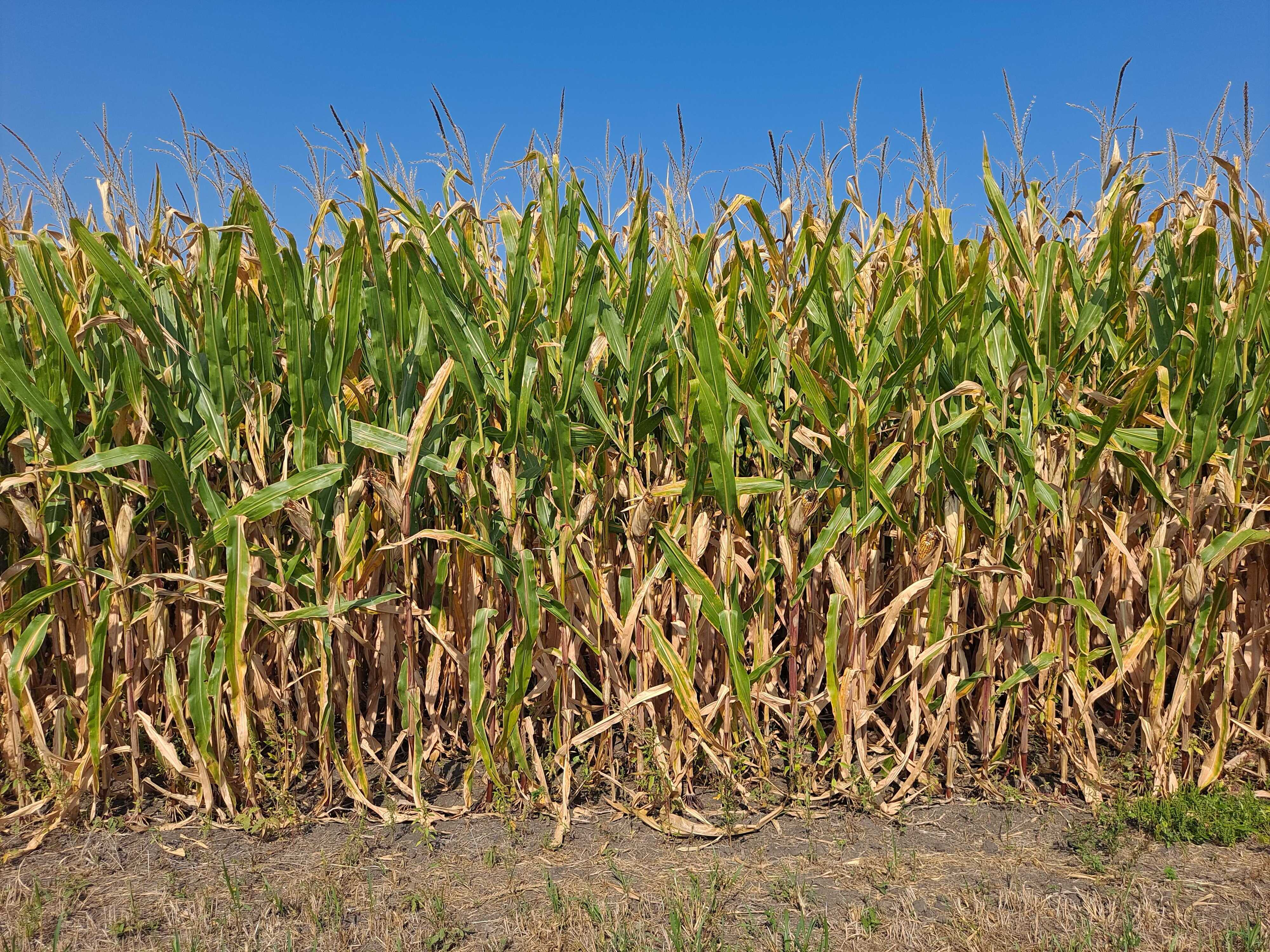
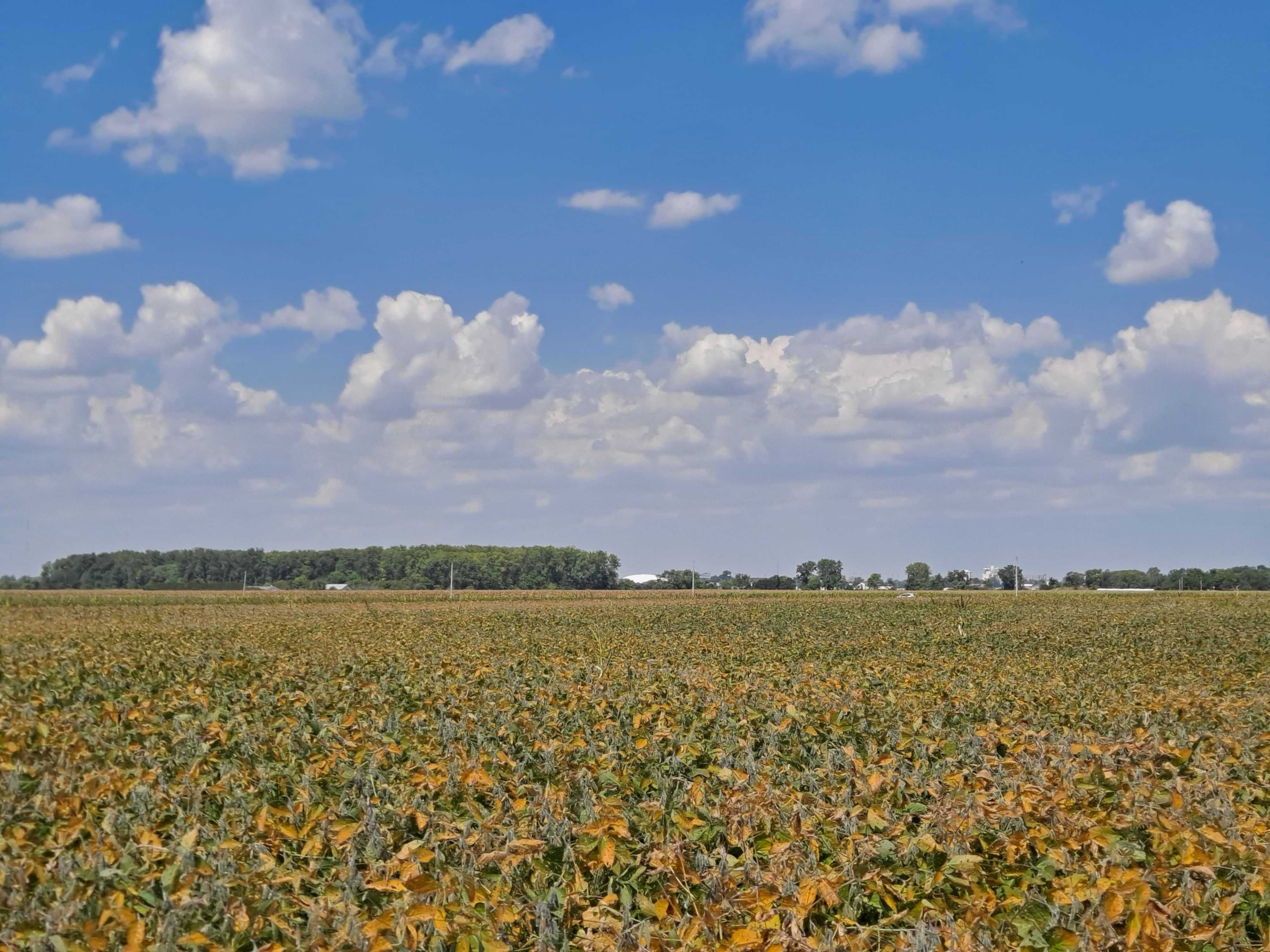
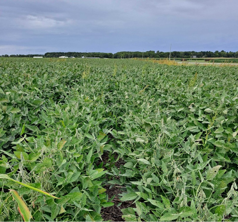
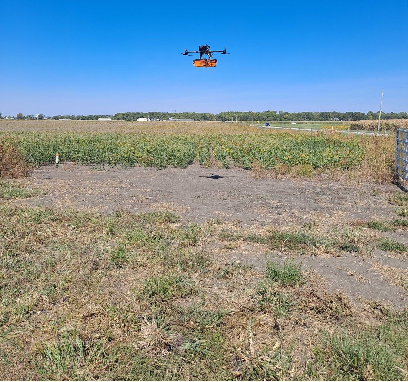
Figure 4: Snapshots of our experimental sites with different canopy coverage, spanning over 9 acres.
Distributions of measured canopy attributes (height, LAI, density) show wide variability, with GreenScatter maintaining consistent performance regardless of field heterogeneity.
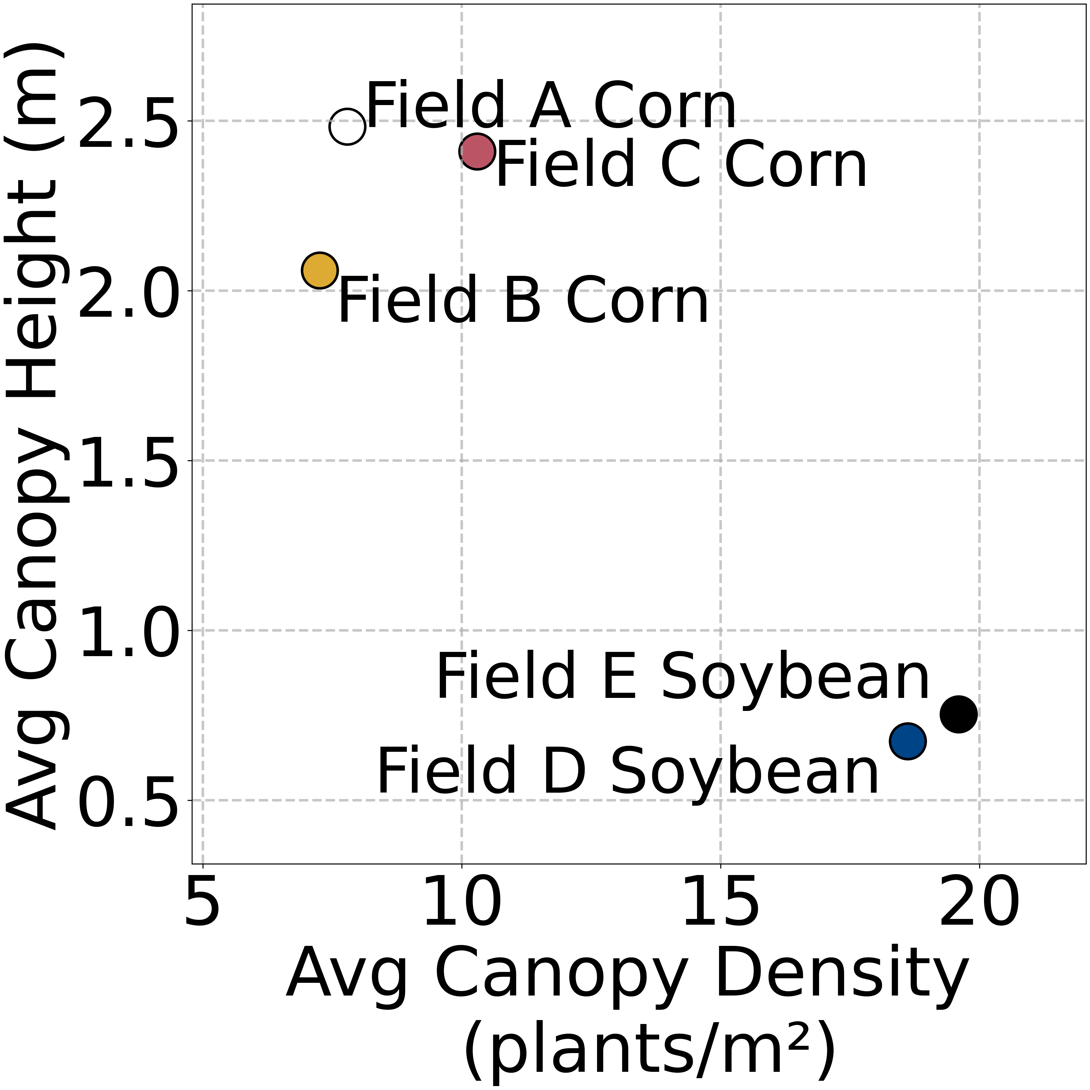
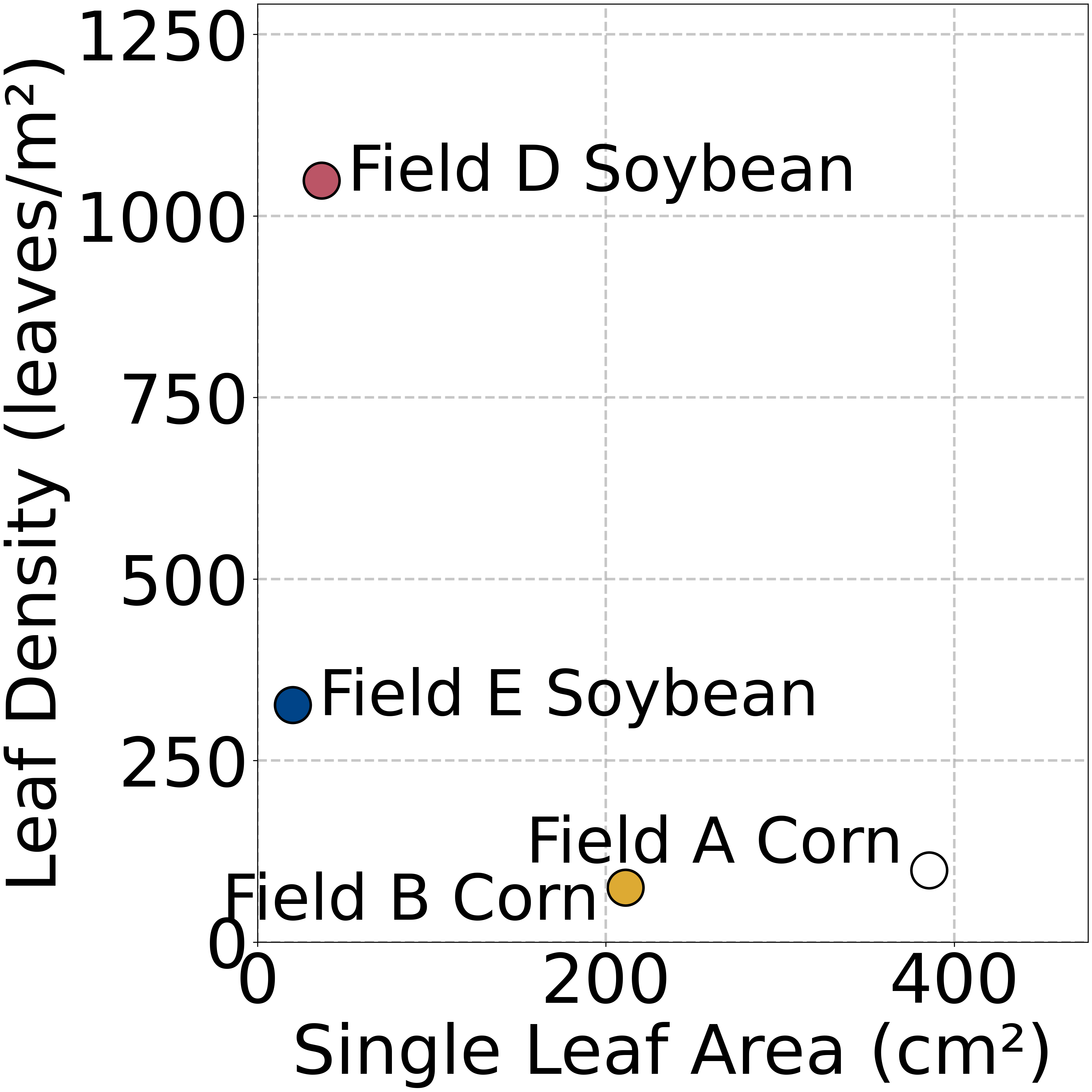
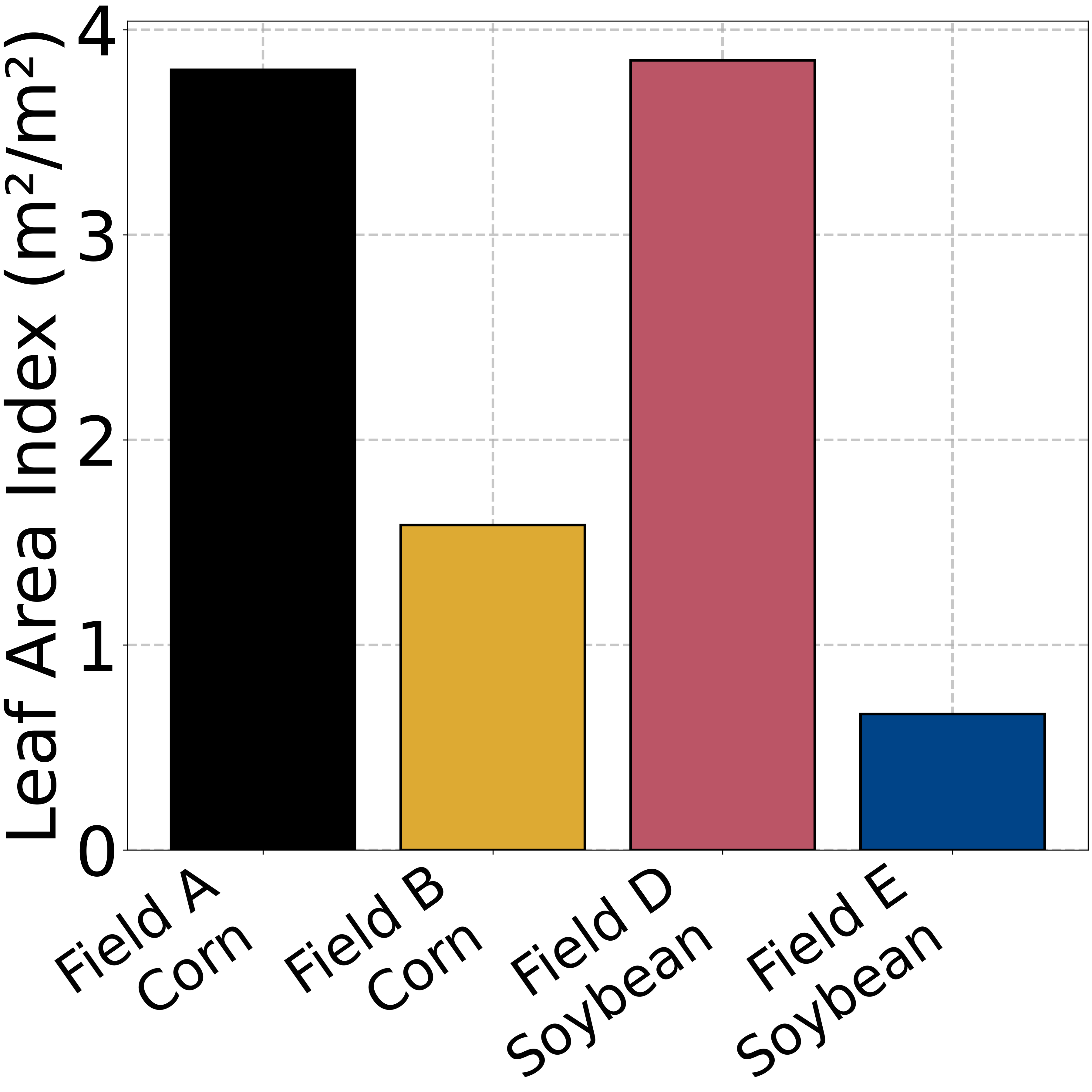
Figure 5: Distribution of canopy coverage parameters across fields.
Numerical results indicate an average VWC MAE of 4.49%, with correlation preserved across the full moisture range (3–26% VWC), and minimal impact of changing UAV altitude (demonstrated altitude normalization and correct modeling of radar footprint). Model ablation studies support the claim that explicit coupling of LiDAR-based canopy modeling is critical: omitting canopy parameterization degrades performance particularly in dense (e.g., green soybean) canopies, reinforcing the necessity of the radiative transfer approach.
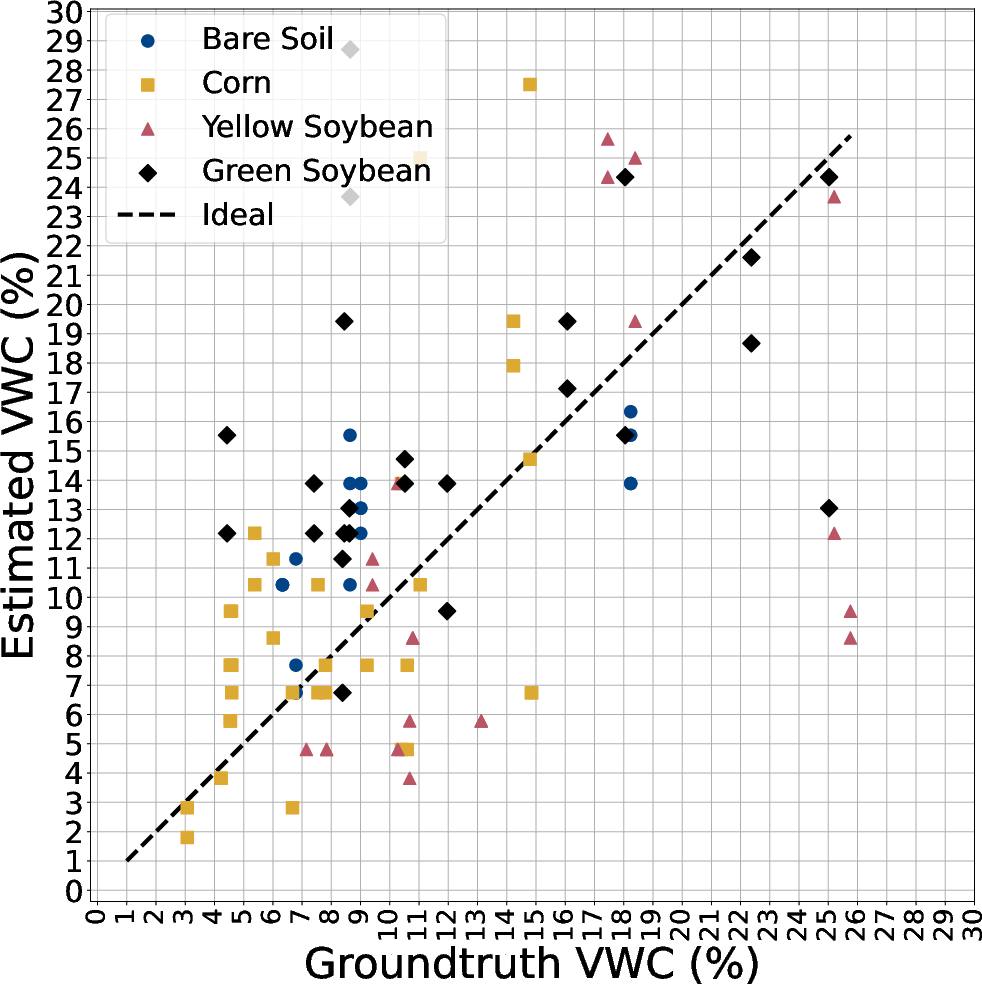
Figure 6: GreenScatter retrieval maintains positive estimation-groundtruth correlations over a wide range of groundtruth soil moistures.
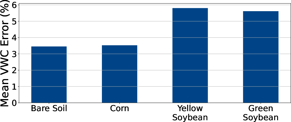
Figure 7: GreenScatter is robust in soil moisture sensing through various canopy covers.
Sensitivity Analysis, Model Ablations, and Canopy Decoupling
A sequence of sensitivity experiments highlights the model’s key operational regimes and physical validity:
- Radar bandwidth reduction: Performance degrades gracefully, quantifying information content in frequency subbands, supporting bandwidth scaling for energy/cost trade-offs.
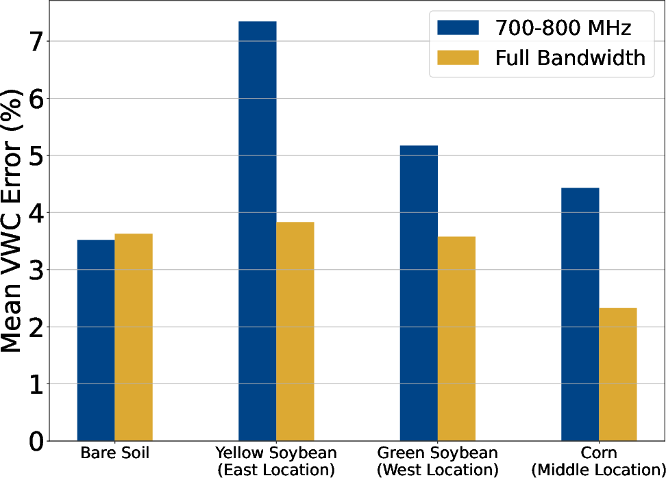
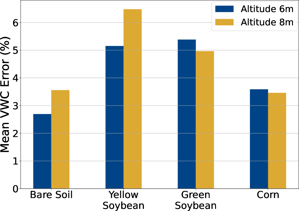
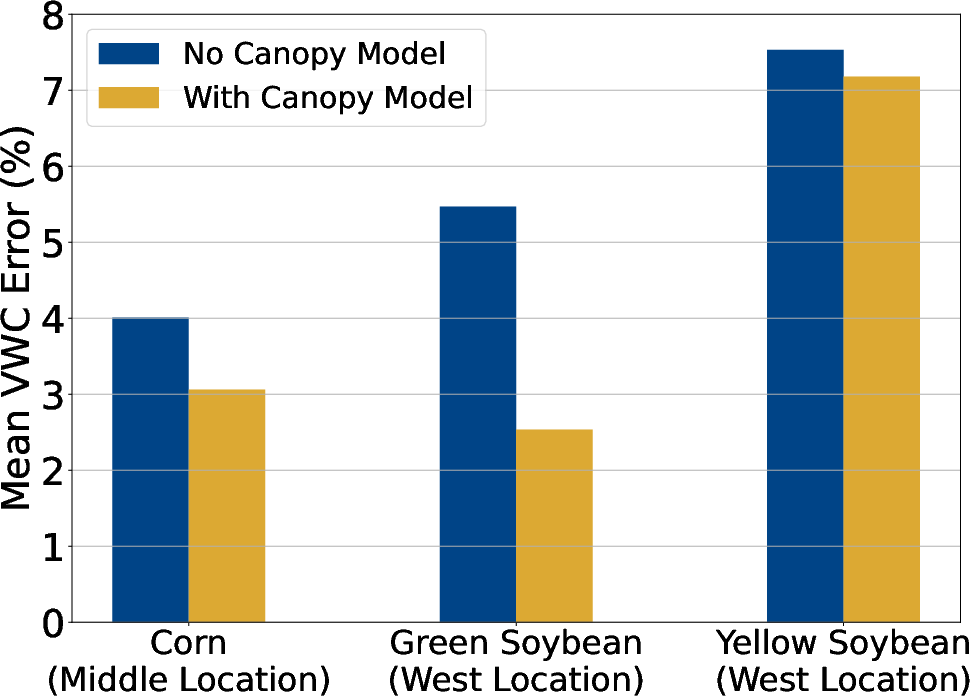
Figure 8: GreenScatter's soil moisture retrieval accuracy using full versus reduced radar bandwidth.
Structural Parameter Estimation from LiDAR Point Clouds
The LiDAR submodule demonstrates high statistical fidelity in leaf area index (LAI), plant density, and canopy height versus field-measured values, with relative errors below 15%. This is achieved through robust voxel-based inversion and crop-allometry tuned for noisy aerial data, standing out in scenarios (mature/dense canopies, significant occlusion) where established static or UAV/mobile LiDAR approaches fail.
Implications, Limitations, and Future Directions
By rendering through-canopy soil moisture retrieval robust, accurate, and generalizable across key crop types and field conditions, GreenScatter significantly reduces the practical need for invasive sensors or manual calibration. The platform’s reliance on a single pre-field calibration target and physics-motivated inversion architecture constitutes a scalable solution for precision agriculture applications, daily irrigation management, and beyond.
Practically, the architecture is hardware-agnostic post-calibration and does not require the deployment of in-situ reflectors or extensive sensor networks. UAV-based acquisition introduces minimal labor or recurring costs.
Ongoing and future work will extend the model to address:
- Subsurface moisture stratification (multilayer dielectric modeling),
- Joint inference of surface roughness (possibly via pre-season LiDAR),
- Application to more heterogeneous or structurally complex canopies (e.g., forests or orchards) with modified canopy parameterization and local geometry adaptation,
- Integration of auxiliary sensors (e.g., IMU for attitude correction during high-wind conditions).
Conclusion
GreenScatter delivers reliable, physically-interpretable, and operationally scalable through-canopy soil moisture retrieval from nadir-looking UAV radar integrating LiDAR-derived canopy structure characterization. The system consistently achieves field-validated VWC errors under 4.5% across typical agricultural regimes. Its design advances the state-of-the-art in UAV-based remote soil sensing and permits direct adoption in the decision loops of farm-scale irrigation management and digital agriculture.