- The paper presents the Firebird framework, which integrates eight datasets to compute fire risk scores with a 71% true positive rate.
- It employs SVM and Random Forest models to identify over 6,000 new inspection targets and improve resource allocation.
- The framework includes an interactive map visualization that enhances decision-making for prioritizing commercial property inspections.
Firebird: Predicting Fire Risk and Enhancing Fire Inspections in Atlanta
Introduction
The paper presents the Firebird framework, an innovative system designed to enhance the fire inspection process of the Atlanta Fire Rescue Department (AFRD) by integrating machine learning, geocoding, and visualization tools. This framework aims to prioritize commercial property fire inspections by computing fire risk scores for over 5,000 buildings in Atlanta, achieving a true positive rate of up to 71% in predicting fires. It also identifies 6,096 new potential properties for inspection, significantly impacting AFRD’s operational efficiency and effectiveness.
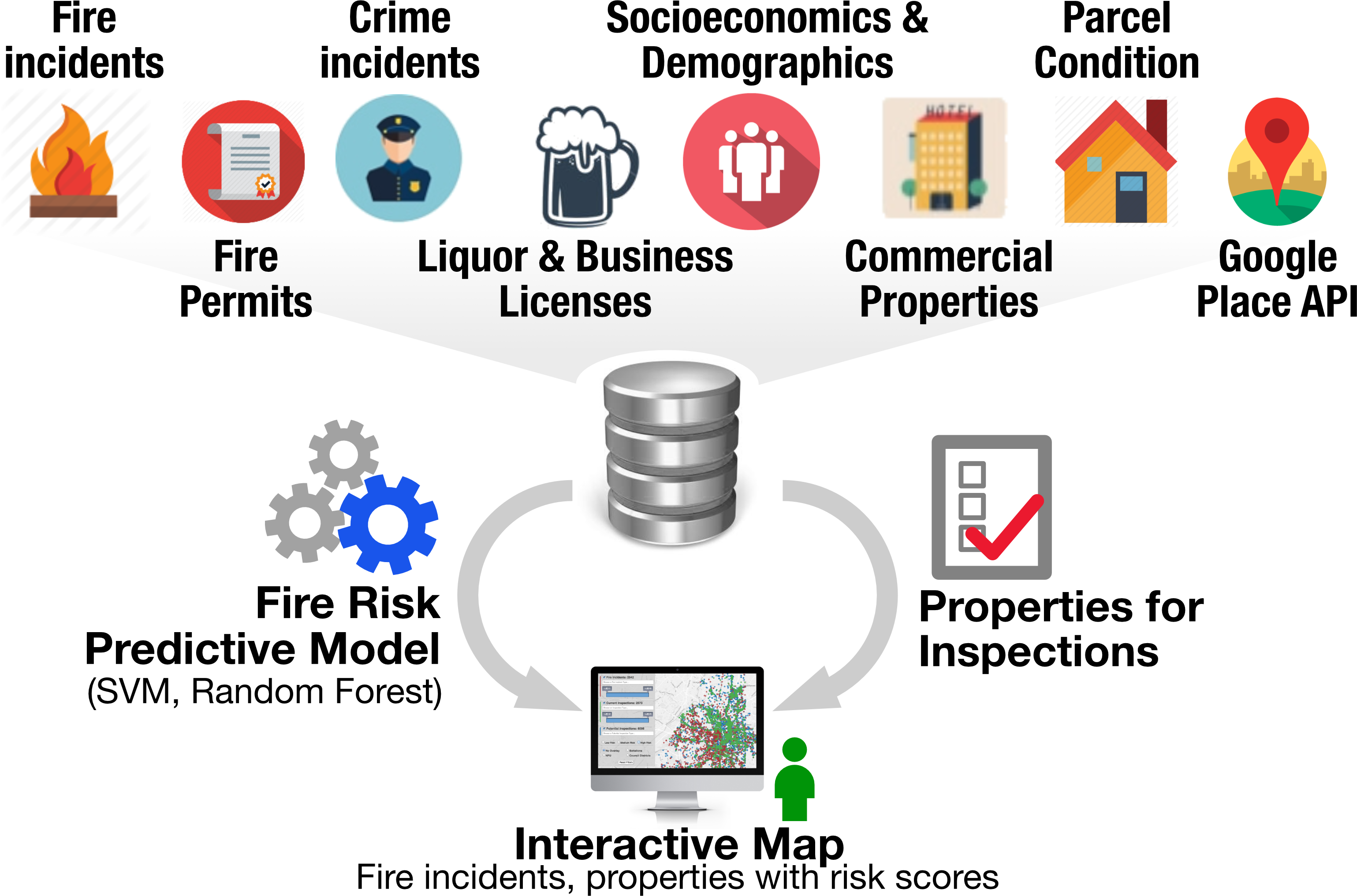
Figure 1: Firebird Framework Overview. By combining 8 datasets, Firebird identifies new commercial properties for fire inspections. Its fire risk predictive models (SVM, random forest) and interactive map help AFRD prioritize fire inspections and personnel allocation.
Data Integration and Property Identification
A critical aspect of the Firebird framework is its ability to integrate multiple datasets, using various spatial information types such as geocode, address, and parcel ID. This integration enabled the identification of 19,397 potential new commercial properties requiring inspection, based on criteria set forth by AFRD.
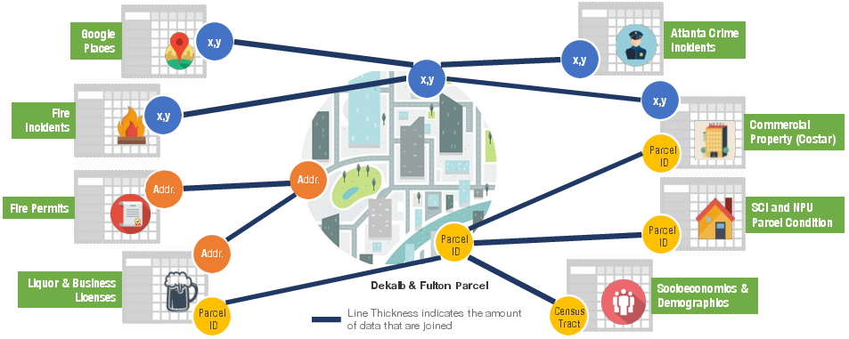
Figure 2: Joining eight datasets using three spatial information types (geocode, address, parcel ID).
Predictive Modeling of Fire Risk
The framework employs machine learning models, specifically Support Vector Machine (SVM) and Random Forest, to predict fire risks. These models analyze building and parcel-level data, achieving high true positive rates while maintaining a manageable false positive rate. The SVM model, in particular, exhibits a 71.36% true positive rate at a 20% false positive rate, allowing AFRD to prioritize inspections with a focus on high-risk properties.
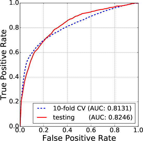
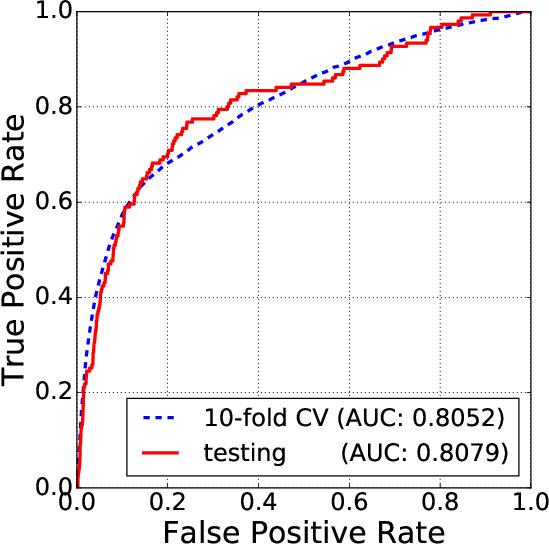
Figure 3: Random Forest.
Interactive Visualization
Firebird also includes an interactive map that visualizes fire incidents, and inspection data, and displays risk scores, enabling AFRD personnel to make informed decisions. This map integrates various datasets into a comprehensive visualization tool, aiding in resource allocation and inspection scheduling.
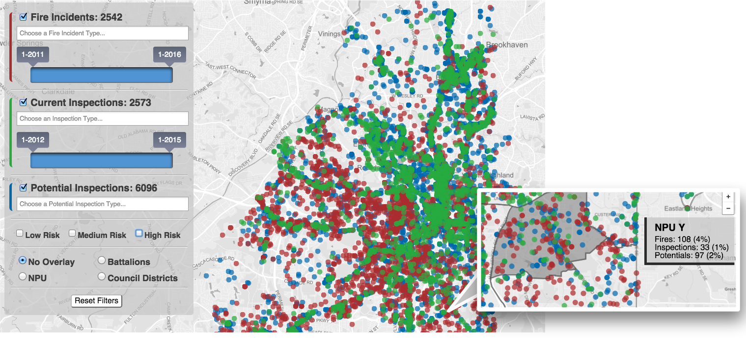
Figure 4: Interactive map of fires and inspections. The colored circles on the map represent fire incidents, currently inspected properties, and potentially inspectable properties in red, green, and blue, respectively. Inspectors can filter the displayed properties based on property usage type, date of fire or inspection, and fire risk score. Callout: activating the Neighborhood Planning Unit overlay allows an inspector to mouse-over a political subdivision of the city to view its aggregate and percentage of the fires, inspections, and potential inspections.
Impact and Implications
Firebird has already made significant impacts on AFRD's operations by streamlining the inspection process and reducing reliance on traditional methods. The approach demonstrates a practical application of data-driven decision-making in municipal governance and is noted as a model for other fire departments. Integrating various datasets has not only improved the efficiency of AFRD but also contributed to the safety of Atlanta's residents by proactively addressing potential fire risks.
Conclusion
The Firebird framework is a testament to the potential for data integration and predictive modeling in enhancing urban fire safety. Future directions could involve expanding the framework to include residential inspections and incorporating more dynamic data sources. The methodology challenges traditional inspection paradigms and offers a replicable model for other municipalities pursuing data-driven public safety improvements.

